


Eastern Upper Peninsula PUMA, Michigan
About
Outline

Summary
| Unique Area Identifier | 193144 |
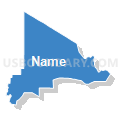
| Name | Eastern Upper Peninsula PUMA |
| State | Michigan |
| Area (square miles) | 16,972.77 |
| Land Area (square miles) | 7,780.67 |
| Water Area (square miles) | 9,192.10 |
| % of Land Area | 45.84 |
| % of Water Area | 54.16 |
| Latitude of the Internal Point | 46.35899700 |
| Longtitude of the Internal Point | -86.02270200 |
Maps


Graphs
Select a template below for downloading or customizing gragh for Eastern Upper Peninsula PUMA, Michigan


Neighbors
Neighoring Public Use Microdata Area (by Name) Neighboring Public Use Microdata Area on the Map
- Marinette, Oconto, Door & Florence Counties PUMA, WI
- Northeast Lower Peninsula PUMA, MI
- Northwest Lower Peninsula (East) PUMA, MI
- Northwest Lower Peninsula (West) PUMA, MI
- Western Upper Peninsula PUMA, MI
Top 10 Neighboring County (by Population) Neighboring County on the Map
- Marquette County, MI (67,077)
- Marinette County, WI (41,749)
- Chippewa County, MI (38,520)
- Delta County, MI (37,069)
- Emmet County, MI (32,694)
- Door County, WI (27,785)
- Dickinson County, MI (26,168)
- Cheboygan County, MI (26,152)
- Charlevoix County, MI (25,949)
- Menominee County, MI (24,029)
Top 10 Neighboring County Subdivision (by Population) Neighboring County Subdivision on the Map
- Sault Ste. Marie city, Chippewa County, MI (14,144)
- Escanaba city, Delta County, MI (12,616)
- Marinette city, Marinette County, WI (10,968)
- Menominee city, Menominee County, MI (8,599)
- Kinross charter township, Chippewa County, MI (7,561)
- Chocolay charter township, Marquette County, MI (5,903)
- Gladstone city, Delta County, MI (4,973)
- Wells township, Delta County, MI (4,885)
- Peshtigo town, Marinette County, WI (4,057)
- Menominee township, Menominee County, MI (3,488)
Top 10 Neighboring Place (by Population) Neighboring Place on the Map
- Sault Ste. Marie city, MI (14,144)
- Escanaba city, MI (12,616)
- Marinette city, WI (10,968)
- Menominee city, MI (8,599)
- Gladstone city, MI (4,973)
- Manistique city, MI (3,097)
- St. Ignace city, MI (2,452)
- Munising city, MI (2,355)
- Newberry village, MI (1,519)
- Stephenson city, MI (862)
Top 10 Neighboring Elementary School District (by Population) Neighboring Elementary School District on the Map
- Moran Township School District, MI (994)
- Autrain-Onota Public Schools, MI (903)
- Wells Township School District, MI (222)
- Bois Blanc Pines School District, MI (95)
Top 10 Neighboring Unified School District (by Population) Neighboring Unified School District on the Map
- Marquette Area Public Schools, MI (32,158)
- Sault Ste. Marie Area Schools, MI (20,637)
- Escanaba Area Public Schools, MI (20,175)
- Marinette School District, WI (15,567)
- Cheboygan Area Schools, MI (14,220)
- Menominee Area Public Schools, MI (12,237)
- Gwinn Area Community Schools, MI (9,903)
- Rudyard Area Schools, MI (9,804)
- Gladstone Area Schools, MI (9,485)
- Calumet Public Schools, MI (8,473)
Top 10 Neighboring State Legislative District Lower Chamber (by Population) Neighboring State Legislative District Lower Chamber on the Map
- State House District 105, MI (95,524)
- State House District 101, MI (92,671)
- State House District 109, MI (90,978)
- State House District 108, MI (87,266)
- State House District 107, MI (86,648)
- State House District 106, MI (86,395)
- State House District 110, MI (83,484)
- Assembly District 89, WI (58,999)
- Assembly District 1, WI (54,189)
- Assembly District 36, WI (50,804)
Top 10 Neighboring State Legislative District Upper Chamber (by Population) Neighboring State Legislative District Upper Chamber on the Map
- State Senate District 35, MI (261,943)
- State Senate District 38, MI (261,728)
- State Senate District 37, MI (258,370)
- State Senate District 1, WI (180,989)
- State Senate District 30, WI (173,432)
- State Senate District 12, WI (157,332)
Top 10 Neighboring 111th Congressional District (by Population) Neighboring 111th Congressional District on the Map
Top 10 Neighboring Census Tract (by Population) Neighboring Census Tract on the Map
- Census Tract 12, Marquette County, MI (5,565)
- Census Tract 9704, Delta County, MI (5,528)
- Census Tract 9706, Chippewa County, MI (4,799)
- Census Tract 9614, Marinette County, WI (4,528)
- Census Tract 9709, Chippewa County, MI (4,511)
- Census Tract 9601, Luce County, MI (4,484)
- Census Tract 9705, Delta County, MI (4,479)
- Census Tract 9602, Marinette County, WI (4,232)
- Census Tract 9502, Dickinson County, MI (4,147)
- Census Tract 9708, Delta County, MI (4,093)
Top 10 Neighboring 5-Digit ZIP Code Tabulation Area (by Population) Neighboring 5-Digit ZIP Code Tabulation Area on the Map
- 49855, MI (33,561)
- 49783, MI (19,668)
- 49829, MI (17,347)
- 54143, WI (15,225)
- 49858, MI (12,088)
- 49837, MI (9,795)
- 49788, MI (6,609)
- 49854, MI (6,469)
- 49868, MI (5,409)
- 49862, MI (5,025)